High Sierra Route Highlights
I would like to share some of my experiences on the trip, but in order
to avoid boring everyone I'm not
going to write an exhaustive chronological account or diary of
events. Instead I'm going to write
down just the most memorable highlights or the events that were most
representative of the journey.
I've chosen to encapsulate each stage in a single word that captures
the overall feel of the stage for me. The five words,
corresponding to each stage, are Challenge, Adventure, Beauty,
Wilderness, and Companionship
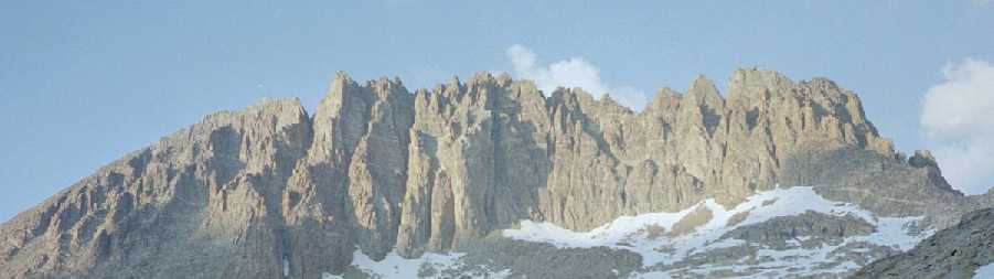
Stage 1 - "Challenge"
The first stage of the trip was definitely the most challenging.
We had weather challenges, nearly being struck by lightning in a
thunderstorm. We had the challenge of gaining the most altitude,
starting at 5000 feet and attaining a height of 14,000 feet. We
had health challenges when Steve felt ill from the altitude and we
decided to hike with him back down to the trail. That presented Clark
and I with the challenge of hiking the steepest 2 mile stretch of the
trip not just once, but twice. We had the challenge of mosquito
stress. We suffered pretty severe and unrelenting mosquito
attacks for several days in a row. We achieved the most
challenging peak climb of the entire trip during this stage with an
ascent of the class 4 LeConte route on North Palisade.
Clark and I had the challenge of learning how to cooperate as teammates
on a backcountry trip and to learn each other's style of coping with
adversity and risk.
One of the worst moments of the entire trip happened hiking across Dusy
Basin surrounded by clouds of mosquitos. Wearing a head net to
keep
from being eaten interfered with my vision. I was trying to cross some
tricky talus and I couldn't see well, and I was slapping at mosquitos
and the slapping threw me off balance so I almost fell. I was
sweating
from the heat and exertion and the nylon net over my head and the sweat
was running in my eyes. It seemed like there was no escape, that
I was
in some Sysiphian nightmare. I felt so frustrated and desperate I
began screaming like a caged animal. If there was a cliff I would
have
thrown myself off just to end the misery.
One of the best moments of the entire trip happened on this stage when
we reached the top of Cirque Pass and a stunning view of Palisade Crest
unveiled before us. Turning around and looking south, as far as
you can see was just mountains, and looking west, mountains all the way
to the horizon. I had a sense of being deeper in the Sierra than
I'd been before and it was surprisingly comforting. I felt I had
reached the "heart" of the Sierra as though I had reached the source of
some elemental, sustaining force. I felt protected having so many
rugged miles between me and the "dangers" of civilization. It was
very satisfying and I felt very happy and content.
Highlights: Watching a mama
bear and her cub.
Dramatic thunderstorm.
Swimming
in a warm lake. Great dinners.
The beautiful
fantasy
landscape of cliffs,
cascades, and wildflowers above Palisade Lakes. Cross
country travel to
Cirque Pass.
Climbing
North Palisade. Meeting nice folks on the John Muir
Trail. A relaxing layover day in Palisade
Basin.
Stage 2 - "Adventure"
The second stage seemed like the most adventurous because we chose to
deviate significantly from Roper's suggested route. Instead of
taking a long, leisurely trail hike through LeConte Canyon and over
tame Muir Pass, we chose to attempt a cross-country mountaineer's route
directly over the crest of the Sierra. My guidebook said that it
was possible to find a shortcut across the crest just north of Mt.
Haeckel that was class 3 in difficulty. We succeeded in crossing
but it was a long and difficult day. Carrying packs across steep
talus and snow and some third class scrambling was no picnic. But we
reached Evolution Basin an entire day sooner than if we had taken the
John Muir Trail. Then the very next day we had another long challenging
cross country hike that included a scary snowfield and an epic talus
field crossing.
Highlights: Getting drenched in a thunderstorm with Bob and
Jaime. Crossing the
Sierra Crest at Haeckel
Col. Sunrise
in
Evolution Basin. Darwin
Bench is fantastic. A steep
snowfield
crossing. Mt.
Humphrey's reflected in Goethe Lake after a bivouac in talus.
Hiking across Humphrey's
Basin with Kevin and
Owhyee. Watching an incredible cascade
flowing down into French
Canyon. Stunning campsite in Bear
Lakes Basin. Great
dinners.
Rendezvous with Lew and Dan for lunch at Lake Italy.
Sunset
after a thunderstorm at Lower McGee Lake.
Stage 3 - "Beauty"
By the time I got to the third stage I had settled into a rhythm of
hiking and living in the backcountry. There were fewer physical
challenges on this stage so I felt I had more time to appreciate the
beauty of the alpine terrain. The hike up the trail from Lake
Edison to Mott Lake was surprisingly scenic. There were lots of
cascades and waterfalls, steep canyon walls, and wildflowers. We
climbed a very fun peak up a third class ridge that was stimulating and
enjoyable. If I had to pick one campsite as the "most beautiful"
spot on the entire trip, it would be Izaac Walton lake. The way
the granite cliffs drop right into the water was really spectacular.
Highlights: Enjoying the absence
of mosquitos. The view
from
the summit of Izaac Walton peak. Great dinners.
Paradise
found at
Izaac Walton Lake. Solo hiking for two days across the Mammoth
Plateau. Night visit by a bear at 11,000'. A real
shower with hot running water (my only one of the trip) at Mammoth
Lakes.
Stage 4 - "Wilderness"
The fourth stage took us through some of the "wildest" terrain of the
whole trip; remote, steep, rugged, pristine, untravelled, and
dramatic. I was really looking forward to the section that would
pass under the east faces of the Minarets and I was not
disappointed. It's really stunning alpine territory of dark
metamorphic rock that has a very different character than the white
granite that we had traversed for most of the trip. We climbed
Foerster Peak on the Yosemite Park eastern boundary and from the summit
we could see southeast across the Ritter Range, Mammoth Crest, Silver
Divide, Mono Divide, Glacier Divide, ... and on and on across miles and
miles of ridge and valley and crest and canyon and mountain, almost as
far as the Palisades we had crossed during Stage 1, and then it hit me
how far we had travelled. "Man," I said to myself, "we have
walked a really long way across some unbelievable territory."
Highlights: Spending a lazy afternoon just soaking in a fabulous
view
of the Minarets and Minaret Lake. Being kept awake much of
the night by the noisy flapping of the tent in a windstorm beneath
Banner
Peak. Watching the sunset on the many tiny islands dotting
Garnet
Lake. A family
of grouse. Great dinners. The intense
blue waters of
Lake Catherine snuggled up beneath Mt. Ritter. The
incredible 2000'
cascade of water that falls into the San Joaquin
watershed. "Rescuing" a golden trout. Dipping
in lovely
Bench Creek. Camping on polished
smooth, utterly flat and clean
granite slabs in Bench Canyon. Climbing
a giant
boulder. A solo
bivy near Vogelsang
Lake.
Stage 5 - "Companionship"
The last stage was pretty easy and for a number of reasons the emphasis
shifted for me from the hiking and the environment to the people
participating with me. My wonderful partner Diana met us in
Tuolumne and along with another friend Roslyn fed us terrific
meals. My long time climbing partner Paul arrived with his wife
Joni. I hiked the last stage with Paul who I've known for many
years and is a wonderful campanion who shares my love of the
outdoors. We share a thirst for adventure that not many other
people can appreciate. It was really special to me to finish the
last days of the journey with him. One last "adventure" that
turned out very fun was taking public transportation all the way from
Tuolumne to my hometown of San Luis Obispo.
Highlights: The scenery in the Twenty
Lakes Basin beneath North
Peak is fantastic. Hiking cross country over McCabe
Pass was very
scenic and super
fun. Discovering an alternative to Roper's directions that
avoided a gnarly bushwhack and was more scenic.
Waking up to
ice
frozen in the cook pot. Camping
on cliffs
above Glen Aulin with an awesome sunset
view of Mt.
Conness. Finishing the last stretch of the hike by cross
country
route over Polly Dome with an unmatched panorama
of magnificent
Tuolumne domes, all the way from Tenaya Peak to Mt. Conness.
I've
spent so much time in Tuolumne it is my favorite "front country" area
of the Sierra. I know the geography extremely well and I've climbed
every significant dome. It is so familiar to me that finishing
the High Route there seemed really natural, like a homecoming.
Home