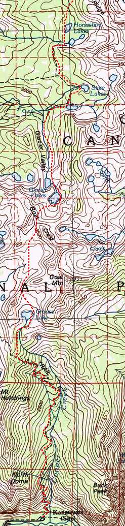
| Day |
Start - End Points |
Terrain |
Miles |
Elevation Gain/Loss |
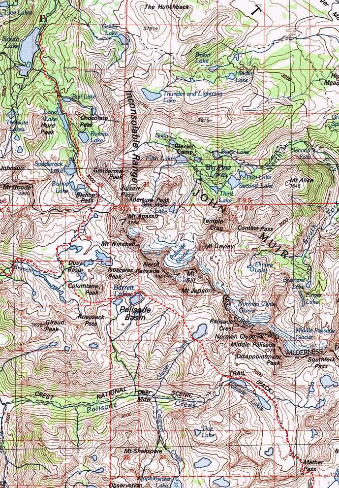
| 1 |
Cedar Grove - Grouse Lake |
Tr |
7 |
+5000 |
| 2 |
Grouse Lake - Lower Glacier Lk | XC |
3.3 |
+1200 - 1000 |
| 3 | Lower Glacier Lk - S. Fork Cartridge Crk | XC |
6.6 |
+1300 - 1700 |
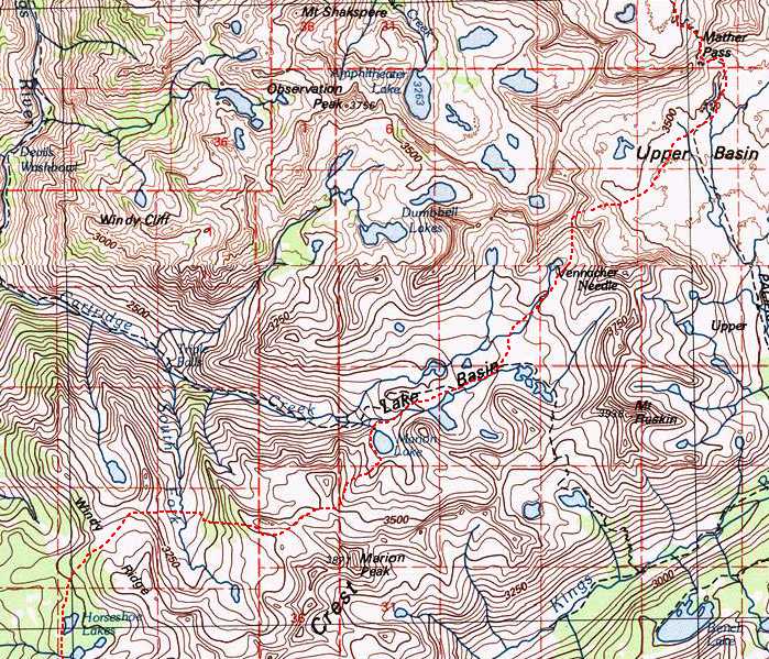
| 4 |
S. Fork Cartridge Crk - Marion Lake |
XC |
2.6 |
+1500 - 1400 |
| 5 |
Layover/Rest |
|||
| 6 |
Marion Lake - Mather Pass |
XC |
5.5 |
+2400 - 1300 |
| 7 |
Mather Pass - Potluck Lake |
Tr/XC |
6.25 |
+2200 - 2000 |
| 8 |
Potluck Lake - Dusy Basin |
XC |
3.5 |
+1200 - 1500 |
| 9 |
Dusy Basin - South Lake |
Tr |
6.5 |
+1000 - 2500 |